

Everything Cimly does.
From the augmented-reality camera to the summit journal: every feature is made for the mountains, with no signal and no account required.
Augmented-reality camera
A name on every peak.
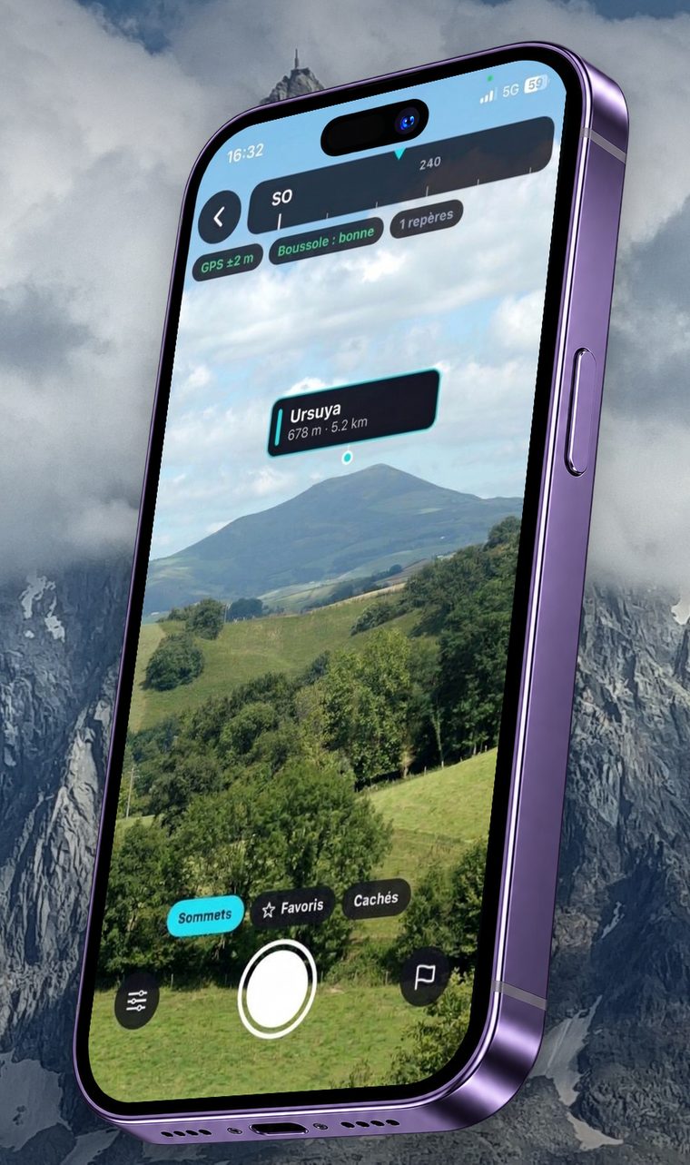
Point your phone at the horizon: the name, altitude and distance of each peak appear right where it stands, in the camera view.
- Terrain is taken into account
- Cimly works out whether a ridge hides a peak from where you stand. Hidden peaks are greyed out, and you choose whether to show them.
- A page for every peak
- Tap a name: altitude, distance, bearing, sunrise and sunset, weather at the peak’s altitude, and an AllTrails search to find a route.
- A confidence bar
- At the top of the screen, GPS and compass show their accuracy, so you know how far to trust what you see.
- AR photo
- Take a photo with the names on screen, add a comment and a smiley, save it or share it.
Dashboard
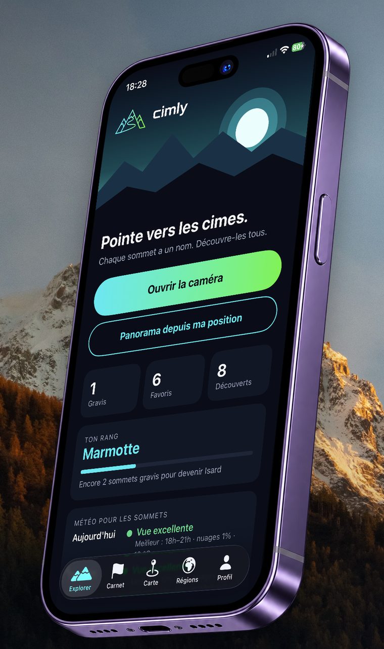
Your rank, your weather, your summits.
On opening, a summary of your season: peaks climbed, favourites, discovered, and the weather that matters for the view.
- A rank that climbs
- From Marmot to Master of the Peaks, via Ibex, Bearded Vulture and Golden Eagle: you progress by climbing peaks.
- Weather for the peaks
- Today’s visibility and the best time slot, at a glance.
- Two shortcuts
- Open the camera, or draw the panorama from where you are.
Map and panorama
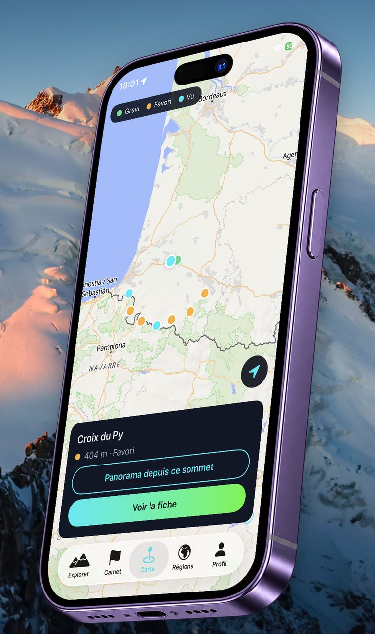
All your peaks on the map.
Climbed in green, favourites in orange, seen in blue: your collection reads at a glance, and you can explore from your sofa.
- Panorama from any point
- Pick a peak or a spot on the map: Cimly draws the 360° horizon out to 60 km, with names ordered by altitude. Drag to turn, pinch to zoom.
- A page for every peak
- Tap a peak on the map to open its page or to see the panorama from its summit.
Summit journal
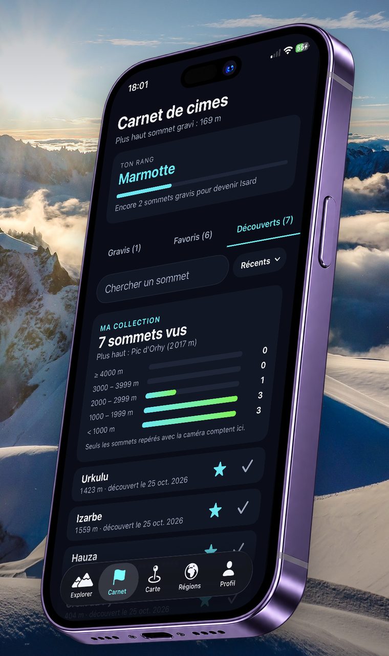
Climbed, favourite, discovered: all noted.
Your hiking history, with a collection sorted by altitude band.
- Three tabs
- Climbed, favourites and discovered, with search by name and sorting by date.
- My collection
- The number of peaks seen in each altitude band, from under 1,000 m to over 4,000 m.
- Discovered = spotted with the camera
- A peak joins your collection once you have spotted it with the camera: no cheating.
Offline
Download your country, go without signal.
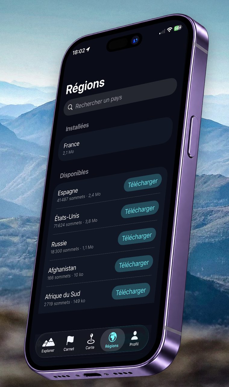
Peaks stay available with no connection: a few MB per country, downloaded once, ideally on Wi-Fi.
- Country packs
- In the Regions tab, choose the countries to keep on your phone. The terrain around you is kept in memory too.
- Local calculation
- Peaks, terrain and visibility are calculated on your phone: you don’t need a signal in the mountains.
- Anywhere in the world
- Tens of thousands of peaks per country, for example over 41,000 in Spain and over 71,000 in the United States.
Free or Premium
Try it free, go Premium when you like.
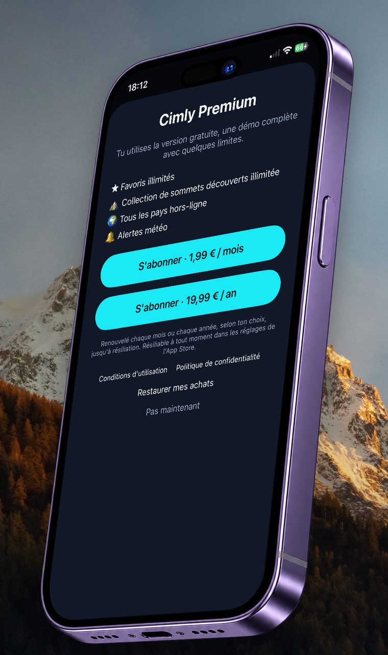
The free version is a full demo. Premium removes the limits and the ads.
- Free to start
- AR camera, panorama, map, journal, friends and weather. With a few limits: 5 favourites, 10 discovered peaks, 1 offline country, and in-app ads.
- Cimly Premium
- Unlimited favourites and peak collection, every country offline, weather alerts, and no more ads.
- No commitment
- The price is shown in the app before you buy. Cancel any time in your App Store or Google Play settings.
The border tells you where you stand.
In the camera, the panorama and your journal, a label’s colour follows your status with each peak.
- Vignemale3 298 mClimbed
You marked it as climbed.
- Vignemale3 298 mFavourite
You want to find it again or go there.
- Vignemale3 298 mNot marked yet
Visible, but no status.
- Hidden
A ridge blocks it from here.
Ready to try it?
Download Cimly, open the camera and point at the horizon.
Weather and friends
Told about the clear views, in good company.
Alerts to know when the view will be clear, and a journal to compare with friends, without ever sharing your location.